Predictive Spatial Intelligence
for Enterprise.
We architect automated remote sensing pipelines and spatial software. Deploy audit-ready ML models on global satellite imagery in minutes.
They see dirt.
We see data.
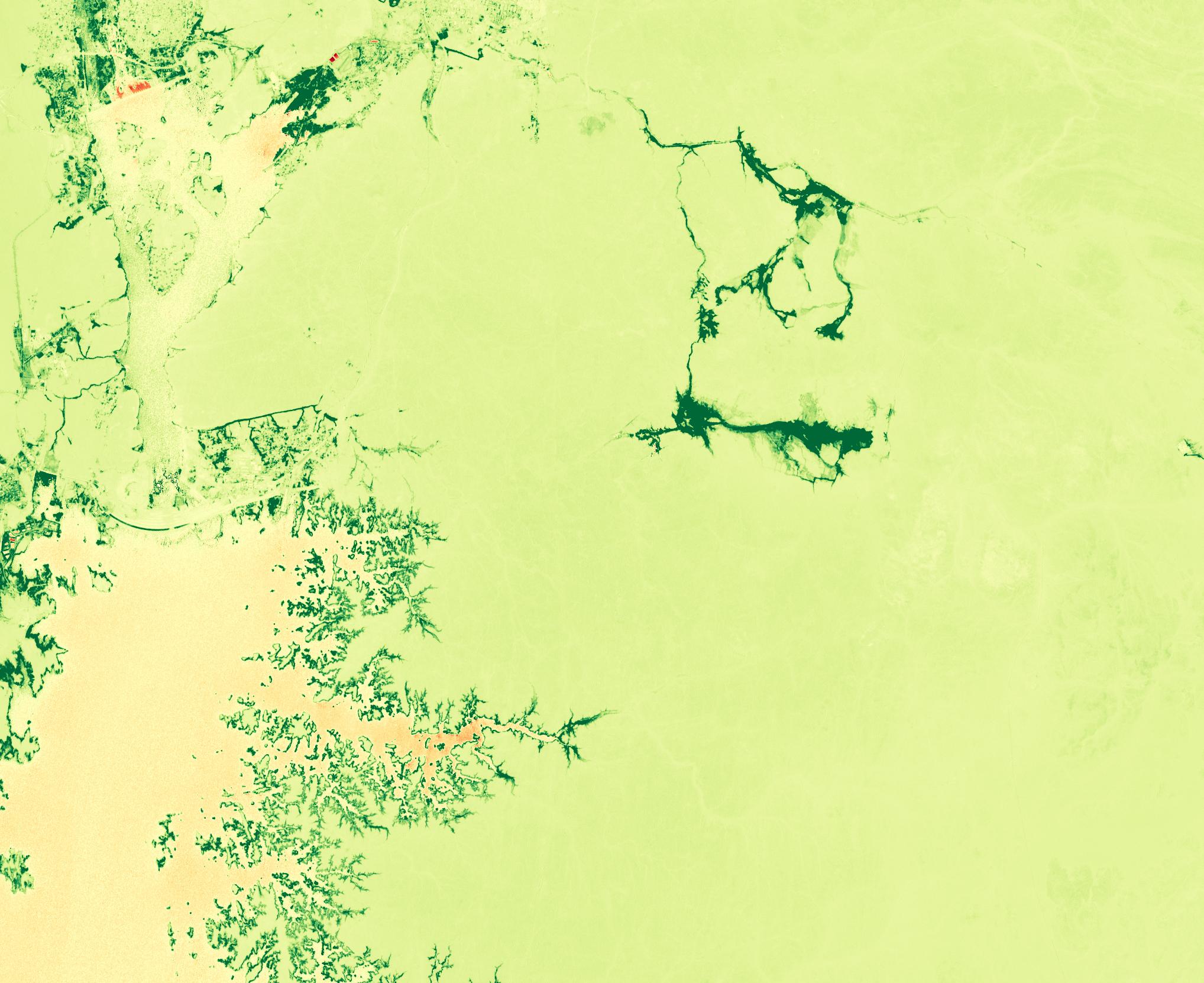
Toggle our multi-spectral analysis layers. We extract invisible insights from standard optical imagery to power your MRV compliance.
Custom Spatial Data Infrastructure
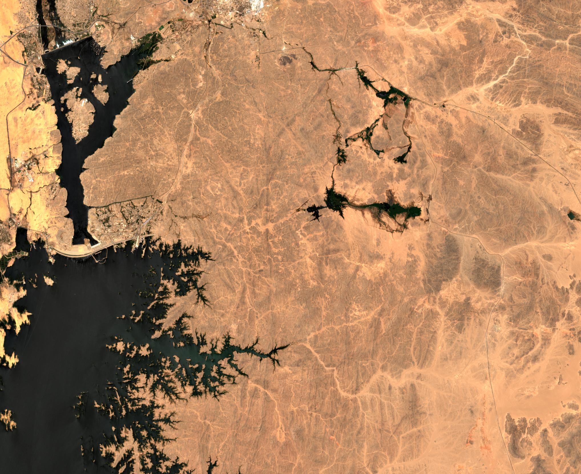
We don't just pull pixels; we architect enterprise data lakes. We fuse multi-spectral optical, cloud-piercing SAR (Sentinel-1), and historical Landsat data into high-performance PostGIS environments.
Proprietary AI & ML Modeling
Move beyond generic indices. We train and deploy custom machine learning models specific to your geography, detecting millimeter-level ground subsidence, illegal encroachment, or species-level biomass.
Engineered for the
physical world.
Automated MRV & ESG
Stop relying on manual audits. We build automated Measurement, Reporting, and Verification pipelines for carbon developers and ESG funds.
Critical Asset Monitoring
Continuous, cloud-piercing surveillance. Monitor millimeter-level shifts in dams, pipelines, and mines before catastrophic failures occur.
Supply Chain Intelligence
Map your physical supply chain. We deploy custom machine learning to predict agricultural yield and track commodity stockpiles globally.
Custom WebGIS Engineering
We don't just hand you raw TIFF files. We build blazingly fast, custom web applications that render millions of spatial data points in your browser.
GeoVerdant case study
A satellite-to-dashboard workflow for operators who need repeatable spatial analysis rather than one-off imagery exports.
From raw imagery to audit-ready review.
GeoVerdant combines NASA HLS data with spectral indices, anomaly detection, and a WebGIS review layer so teams can move from pixels to decisions without manual spreadsheet work.
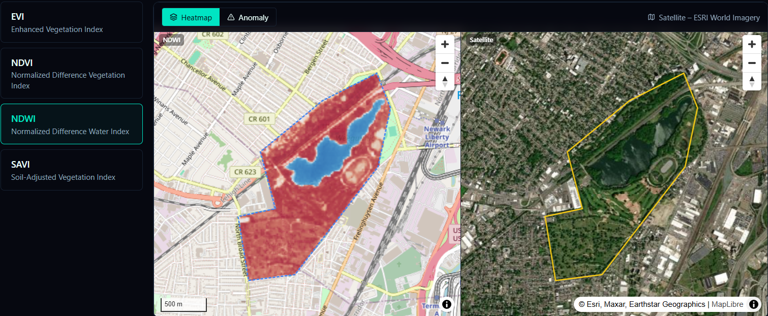
Real-time vegetation health monitoring and normalized difference vegetation index analysis.
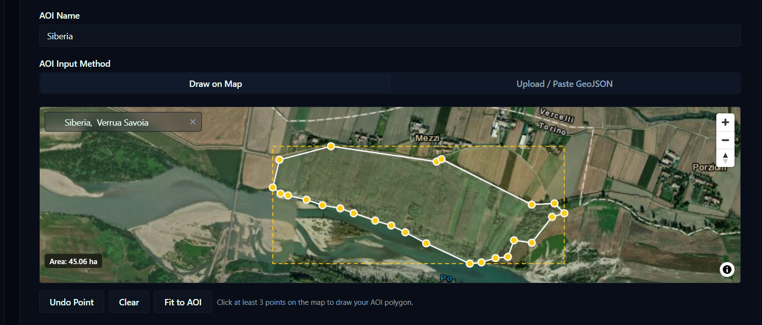
Intuitive geographic selection tools for targeted analysis and reporting workflows.
Enterprise Architecture
Pricing signal for qualified leads.
Most projects begin with a scoped audit, then expand into a managed pipeline or a licensed platform depending on the delivery model.
Scoping & Audit
A focused review of your spatial data, workflows, and deployment path.
Managed Pipeline
Ongoing support for ingestion, model updates, and operational monitoring.
SaaS Licensing
White-label or internal platform licensing for GeoVerdant-style delivery.
Download the Architecture Guide.
Get comprehensive access to our spatial data pipelines, API specifications, and integration frameworks. Sent straight to your inbox.
We respect your inbox. No spam, ever.
Answers to the questions buyers ask first.
Founder-led, operator-minded.
Nexus Geospatial
Nexus Geospatial is a founder-led studio focused on remote sensing pipelines, enterprise spatial software, and the bridge between satellite data and decision-making. The work is deliberately direct: fewer dashboards, more operational clarity.